Maps & Figures
Figure M-1
Multimodal Circulation Network
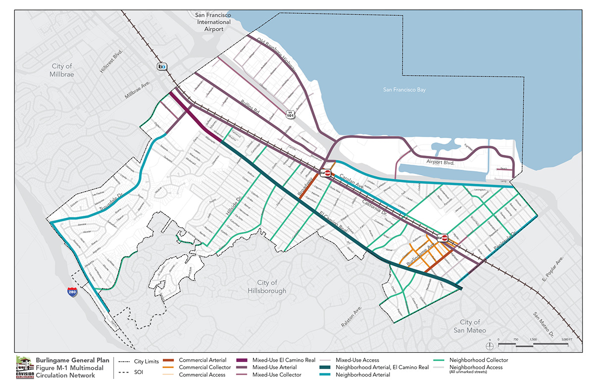
Figure M-2
Multimodal Bicycle Network
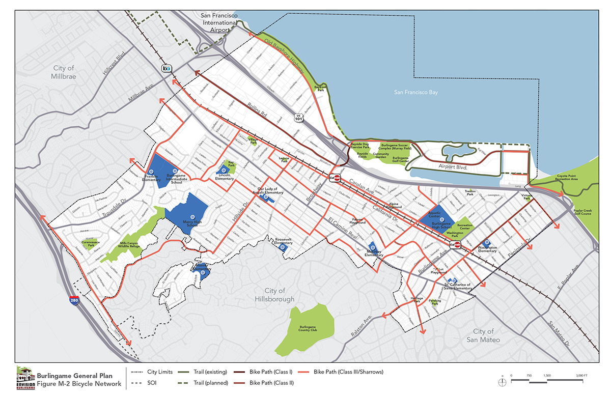
Figure M-3
Cross Section for Bicycle Classes
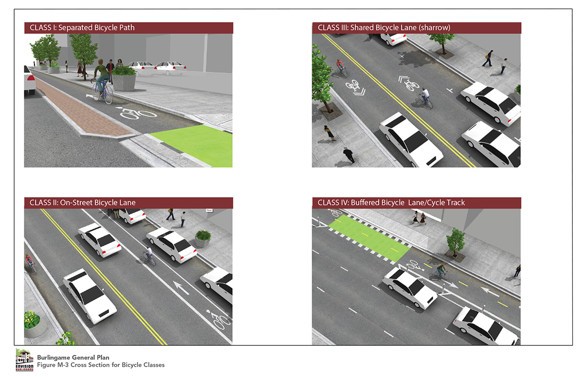
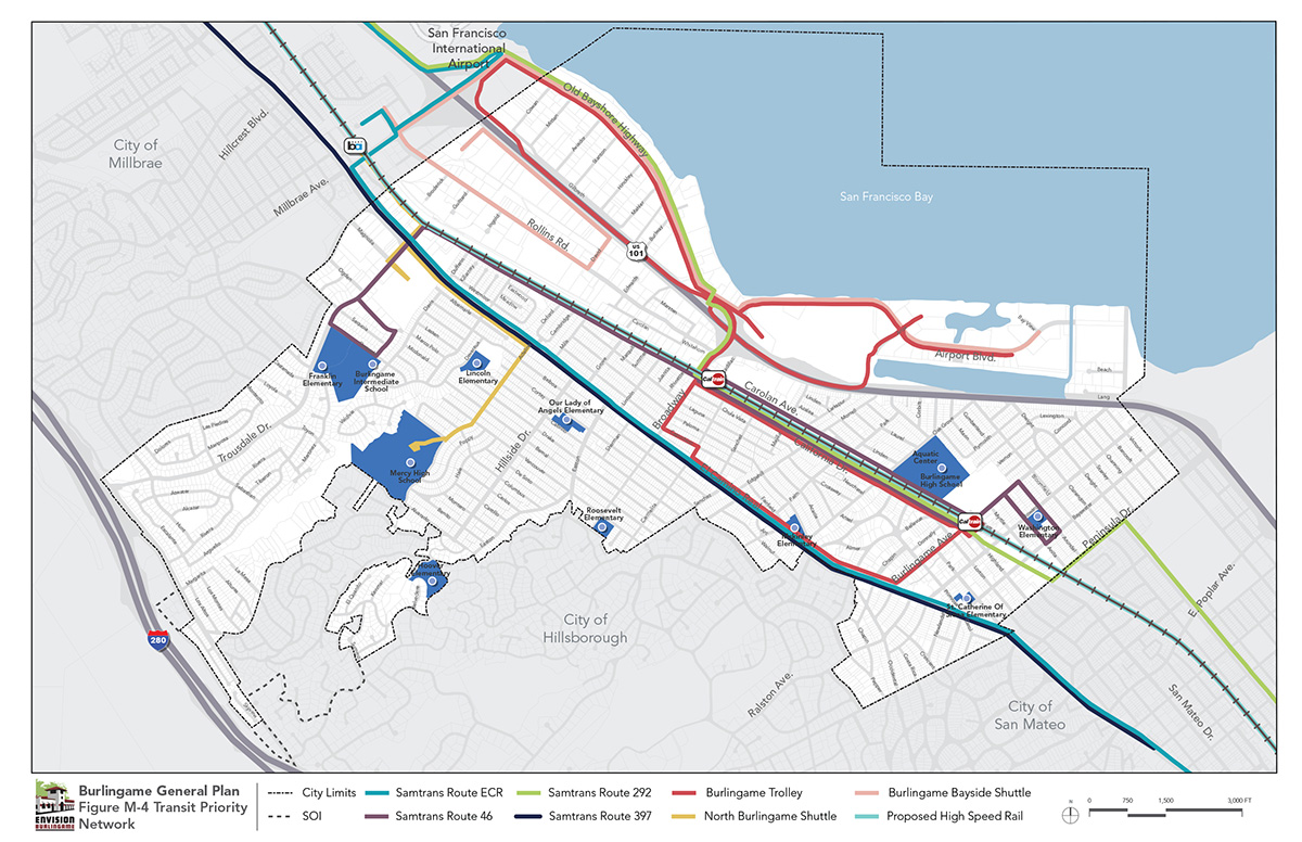
Figure M-4
Transit Priority Network